Southern Highlands
Southern Highlands bushwalks
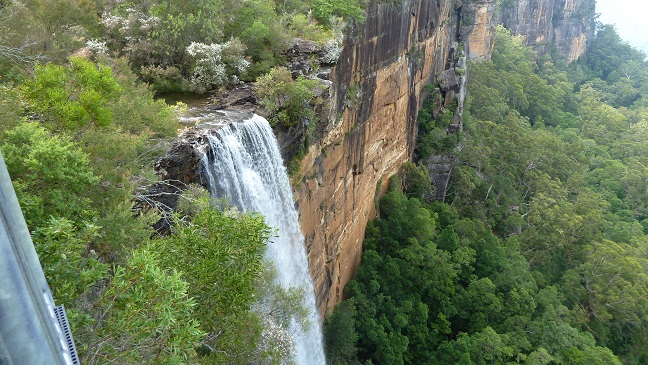
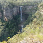
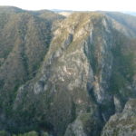
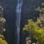
Fitzroy Falls, Morton National Park
I recently got a contract in Canberra which involved driving from Sydney to Canberra each week. The upside of doing this 560km round trip was I got to explore what was in between these 2 great cities.
The Southern Highlands has plenty to offer and this was the first area I wanted to checkout on my mini road trips. Below are the highlights of my weekly pit stops through this region:
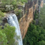
Fitzroy Falls, Morton National Park Distance: 4km – West Rim track
Distance: 7km – East Rim track Difficulty: Easy 80%. A couple of sections medium. Where: Morton National Park, north of Kangaroo Valley. Rating: 5 stars |

Nattai National Park Distance: 16km loop |
Bundanoon – Glow Worm Glen Distance: 2km return. |
Belmore Falls – Morton National Park Distance: 1.8km return. |
Bungonia National Park. Distance: 2km return. |
Carrington Falls Distance: 1km, 4km, 10km. |
loading map - please wait...
Tags
Southern Highland bushwalks, hikes, trek, walk, Southern Highland hikes, Southern highland waterfalls.