Nattai National Park
Nattai National Park Bushwalk.
Nattai National Park Hike snapshot:
Distance: 16km loop
Where: Nattai National Park.
Difficulty: Hard.
Rating: 5 Stars
-
Nattai National Park Bushwalk.
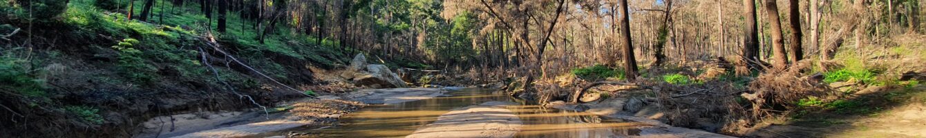
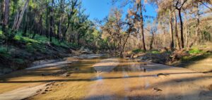 The Starlights trail in the Nattai National Park isn’t for the novice bushwalker. The trail is hard with extremely steep slopes. This track is recommended for experienced bushwalkers only. It’s very easy to loose the trail so ensure you take a map with you.
Even thought this walk is on the hard side, it’s extremely rewarding and well worth doing. The views of the surrounding cliffs are amazing. Once you make your way down to the bottom there is a very enjoyable hike along the Nattai River which will not disappoint.
Then there’s a steep climb to get out of the Nattai river valley which is guaranteed to get the heart pounding.
I really enjoyed this walk and it was great for fitness. I highly recommend checking it out.
Directions to Nattai National Park trail head.
Google Map Link. Drive to Hill top then head down Wattle Ridge Road. Drive to the end of the road and you will arrive at the car park. There is a national park sign mapping the area. Wattle Ridge Rd turns into a dirt road for the last 10 mins. It is suitable for 2wd vehicles.
-
Nattai National Park Hike Trail Map.
 Nattai National Park
loading map - please wait...
- Submit your reviewTrail MazeAverage rating: 0 reviews
-
Nattai National Park Bushwalk Photo Gallery.
-
Nattai National Park Youtube Clip.
-
Directions to Nattai National Park trail head.
Google Map Link. Drive to Hill top then head down Wattle Ridge Road. Drive to the end of the road and you will arrive at the car park. There is a national park sign mapping the area. Wattle Ridge Rd turns into a dirt road for the last 10 mins. It is suitable for 2wd vehicles.
The google map below can assist with directing you to the Wattle Ridge Rd Car park trail head:
Tags:
Bushwalk southern highlands, Hikes southern highlands, Nattai Hike, Nattai Bushwalk.