Shoalhaven River Seven Mile Beach
Shoalhaven River Seven Mile Beach, Kayaking.
Shoalhaven River kayaking snap shots:
Distance: 10-20+km
Where: Shoalhaven.
Difficulty: Easy/Medium.
Rating: 4 1/2 Stars
-
Shoalhaven River Seven Mile Beach Kayaking.

Shoalhaven River
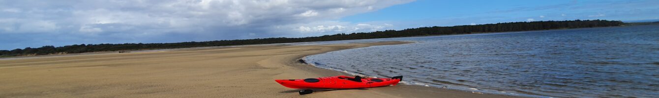
There are a number of kayaking day trips you can do on the Shoalhaven River. One that offers plenty of adventures is a paddle towards Seven Mile Beach. You can go as far as you want on this paddle. The shortest trip option is around 10km. Start from Shoalhaven Heads, loop around Kurrajong Island then head towards Seven Mile Beach. The loop around Kurrajong is magnificent with the Illawarra escarpment in the backdrop, mangroves, plenty of pelicans and swans hovering around. Next stop at Seven Mile Beach. It’s worth parking the kayaking at the beach and having a look around. Plenty of photo opportunities here.
If you’d like a longer paddle start form Back Forest boat ramp. Loop around Numbaa Island ( I didn’t get to do this) and Kurrajong Island then head towards Seven Mile Beach. This paddle will be around the 20+km mark.
I’ve rated the paddle easy to medium as boats do use this river and it can get a little choppy in certain sections. However anyone with a bit of paddling ability will have no issues.
The river can get a bit shallow as you head towards Seven Mile beach or get too close to Kurrajong Island. I went at low tide and had a log drag due to the shallow water. The ideal time to go would be high tide.
For a great feed after the paddle go to the Heads Hotel. The beer garden is perfect after a big day on the river. The kiosk on the beach is also pretty good.
I highly recommend this.
Directions to Shoalhaven River Seven Mile Beach kayak drop.
Google Map Link. Click on the google map link to get directions to the boat ramp on Hay Ave, Shoalhaven Heads.
Google Map Link. Click on the google map link to get directions to the boat ramp Back Forest Rd, Back Forest.
-
Shoalhaven River Seven Mile Beach Kayaking Map.
The map below show the kayak launch from Shoalhaven Heads.
 Shoalhaven River Seven Mile Beach
loading map - please wait...
The following map is the kayak launch from Black Forest
Shoalhaven River Back Forestloading map - please wait...
- Submit your reviewTrail MazeAverage rating: 0 reviews
-
Shoalhaven River Seven Mile Beach Kayaking Photo Gallery.
-
Shoalhaven River Seven Mile Beach Kayaking Youtube Clip.
-
Directions to Shoalhaven River Seven Mile Beach kayak drop.
Google Map Link. Click on the google map link to get directions to the boat ramp on Hay Ave, Shoalhaven Heads.
Google Map Link. Click on the google map link to get directions to the boat ramp Back Forest Rd, Back Forest.
Below is a map of the area:
Tags:
Shoalhaven Kayaking, Illawarra kayaking.