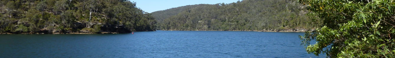
Apple Tree Bay
Mount Ku-ring-gai to Apple Tree Bay.
Distance: 10km return.
Where: Ku-ring-gai National Park.
Difficulty: Medium.
Rating: 4 Stars
-
Mount Ku-ring-gai to Apply Tree Bay.

Apple Tree Bay
The Mount Kuring-gai to Apple Tree Bay to Bobbin head bushwalk has plenty to offer. Access to the trail head is easy via car or a train to Mt Ku-ring-gai station.
The first half of the track is a descent down to Cowan Creek. The views of the creek are excellent as you make your way through granite boulders in a typically Australian bush setting. Once down at water level make your way along the creek to Apple Tree Bay. A short distance further is the Bobbin head cafe which is a great place to grab a bit and enjoy the views before tackling the trek back up Mt Ku-ring-gai.
All up a great hike which a highly recommend.
Directions to Apple Tree bay bushwalk.
Google Map Link. Drive to the end of Harwood Ave or catch a train to Mt Ku-ring-gai station. At the start of the track you’ll see a sign say “Mt Kuring-gai Track”.
-
Apple Tree Bay Trail Map.
 Apple Tree Bay
loading map - please wait...
- Submit your reviewTrail MazeAverage rating: 0 reviews
-
Apple Tree Bay Photo Gallery.
-
Apple Tree Bay Youtube Clip.
-
Directions to Apple Tree Bay Bushwalk.
Google Map Link. Drive to the end of Harwood Ave or catch a train to Mt Ku-ring-gai station. At the start of the track you’ll see a sign say “Mt Kuring-gai Track”.
Tags:
Bushwalking north Sydney, Ku-ring-gai bushwalks, Mount Kuring-gai, apple tree bay, bobbin head, tracks, trails, hike, trek.