Kayaking

Australia Kayaking

Australia has some awesome river systems to explore via a kayak or canoe. The trips can Range from overnight paddles to short day trips.

Below are TRAILMAZE’s best kayaking paddles in NSW

Kangaroo Valley

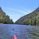
Kangaroo Valley, Tallowa Dam

Distance: 26km return
Difficulty: Easy. Nice and flat. No power boats.
Rating: 5 stars
Location: Sydney South
Nepean River

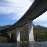
Nepean River

Distance: 20+km return
Difficulty: Easy. Nice and flat.
Rating: 5 stars
Location: Sydney West
Woronora River

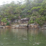
Woronora River

Distance: 12km return
Difficulty: Easy. Nice and flat.
Rating: 4 stars
Location: Sydney South
Royal National Park

Hacking River

Distance: 20+km return
Difficulty: Easy. Nice and flat. 
Rating: 4 stars
Location: Sydney South
Bents Basin

Bents Basin

Distance: 20km return
Difficulty: Easy. Nice and flat. 
Rating: 4 stars
Location: Sydney South
Georges River 

Georges River

Distance: 20+km return
Difficulty: Easy. Nice and flat. 
Rating: 4 stars
Location: Sydney South
Minnamurra River

Minnamurra River

Distance: 15km return
Difficulty: Easy. Nice and flat. 
Rating: 4 and a half stars
Location: Illawarra

Broughton Creek

Distance: 25km return
Difficulty: Easy. Nice and flat. 
Rating: 4 and a half stars
Location: Berry


Shoalhaven River Kayaking

Upper Shoalhaven River

Distance: 15+km return
Difficulty: Easy.. 
Rating: 5
Location: Bamarang

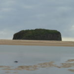
Shoalhaven River Seven Mile Beach

Distance: 10-20+km return
Difficulty: Easy/Medium.
Rating: 4 1/2 Stars
Location: Shoalhaven Heads

Shoalhaven River Nowra Bridge

Distance: 20+km return
Difficulty: Easy/Medium.
Rating: 4 1/2 Stars
Location: Nowra.


Some of the best places to kayak in Queensland:


Noosa everglades.

Distance: 20+km return
Difficulty: Easy. 
Rating: 5 stars
Location: Noosa

Noosa River

Distance: 20+km return
Difficulty: Easy. 
Rating: 5 stars
Location: Noosa


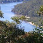
Kayaking is a great way to clear the mind and get a bit of fitness and fresh air. This site will attempt to clearly describe the kayak or canoe trip which will include, maps which you can zoom in and out, have photo galleries for you to browse through so you can determine if the kayak paddle would be something your interested in and a short youtube clip with highlights of the trip. There is also a review section so you can add your two cents worth.


The map below contains some excellent kayak trips to explore. Use the plus and minus icons to zoom in and out on the map. You can also change your map type to say satellite.

Hope you find the information you were after.

Export as KML for Google Earth/Google MapsOpen standalone map in fullscreen modeCreate QR code image for standalone map in fullscreen modeExport as GeoJSONExport as GeoRSS
Kayaking - NSW

loading map - please wait...

Georges River: -33.980679, 150.996950
Woronora RIver: -34.019228, 151.051417
Nepean River: -33.763682, 150.664836
Hacking RIver: -34.062037, 151.079457
Kangaroo Valley, Tallowa Dam: -34.771121, 150.315858
Bents Basin: -33.931001, 150.631775
Douglas Park: -34.193275, 150.713110
Minnamurra River: -34.628759, 150.859022
South West Arms: -34.076407, 151.123062
South West Arms 2: -34.061192, 151.080490
Bundanoon Creek: -34.769961, 150.316143
Broughton Creek: -34.790087, 150.696502
Shoalhaven River Bamarang: -34.903179, 150.498190
Shoalhaven River Seven Mile Beach: -34.859524, 150.730276
Shoalhaven River Back Forest: -34.847128, 150.675688
Shoalhaven River Nowra Bridge West: -34.862553, 150.598183
Shoalhaven River Nowra Bridge East: -34.858820, 150.607195
Noosa Everglades: -26.257397, 152.996635
Noosa River: -26.398020, 153.061352
marker icon
Get directions Open standalone map in fullscreen mode Export as KML for Google Earth/Google Maps
Georges River

Georges River

Georges River Kayak, launch at Fitzpatrick Park, at the end of Carinya Rd, Picnic Point. There are plenty of easy spots around there to get your kayak into the water.

Carinya Rd, Picnic Point, New South Wales, Australia
marker icon
Get directions Open standalone map in fullscreen mode Export as KML for Google Earth/Google Maps
Woronora RIver

Woronora River

Woronora River Snapshot:

Where:       Launch from Woronora River boat ramp.

Distance:   13km return trip to the needles

Difficulty:   Easy. Nice and flat for beginners

Rating:      4 Stars

Woronora River, Sydney, New South Wales, Australia
marker icon
Get directions Open standalone map in fullscreen mode Export as KML for Google Earth/Google Maps
Nepean River

Nepean River

Nepean River Kayak. Kayaking on the Nepean river beat all my expectations. Paddling through the gorges was an amazing experience. I started my kayak adventure down the Nepean River early. Just 15 minutes into the trip and you feel like your in wilderness. I had the place to myself. I kayaked for 2 hours, 15 km’s until I reached the Nepean River and Warragamba River junction.

Nepean River, New South Wales, Australia
marker icon
Get directions Open standalone map in fullscreen mode Export as KML for Google Earth/Google Maps
Hacking RIver

Hacking River

6km return from Swallow Rock boat ramp to Audley.

Swallow Rock Boat Ramp, Grays Point, New South Wales, Australia
marker icon
Get directions Open standalone map in fullscreen mode Export as KML for Google Earth/Google Maps
Kangaroo Valley, Tallowa Dam

Kangaroo Valley, Tallowa Dam

This is the best Kayak I have done to date. Only 15mins into the paddle your already at Shoalheaven gorge which is sensational. 5 star rating.

Tallowa Dam Picnic Area, Tallowa Dam Road, Moollattoo, New South Wales, Australia
marker icon
Get directions Open standalone map in fullscreen mode Export as KML for Google Earth/Google Maps
Bents Basin

Bents Basin, Kayaking.

Distance: Approximately 20km return.

Difficulty: Easy. A few fallen trees. Harder after rain.
Launch: Wallacia, Fowler Reserver
Rating: 3 stars.

Bents Basin, Greendale, New South Wales, Australia
marker icon
Get directions Open standalone map in fullscreen mode Export as KML for Google Earth/Google Maps
Douglas Park

Douglas Park, Nepean River

Nepean River, kayaking from Douglas Park to Menangle Reserve
Distance: 14km one way
Where: Launch at Douglas Park Drive, near the bridge
Difficulty: Easy
Rating: 4 Stars 

 
marker icon
Get directions Open standalone map in fullscreen mode Export as KML for Google Earth/Google Maps
Minnamurra River

Minnamurra River Kayaking.

Minnamurra River kayaking snapshot:
Distance: 15km return.
Where: James Oak Reserve.
Difficulty: Easy.
Rating: 4 Stars.

Minnamurra, Kiama Downs, Australia
marker icon
Get directions Open standalone map in fullscreen mode Export as KML for Google Earth/Google Maps
South West Arms

South West Arm. Off hacking River.

Swallow Rock Drive New South Wales, Australia
marker icon
Get directions Open standalone map in fullscreen mode Export as KML for Google Earth/Google Maps
South West Arms 2

South West Arms launched from Swallow Rock 

Swallow Rock Drive New South Wales, Australia
marker icon
Get directions Open standalone map in fullscreen mode Export as KML for Google Earth/Google Maps
Bundanoon Creek

Bundanoon Creek kayaking snapshot:

Distance: 16km return

Where: Kangaroo Valley

Difficultly: Easy

Rating: 5 Stars

marker icon
Get directions Open standalone map in fullscreen mode Export as KML for Google Earth/Google Maps
Broughton Creek

Broughton Creek

Difficulty: Easy

Distance: 25km

Where: Berry, NSW

Rating: 4 and a half stars

marker icon
Get directions Open standalone map in fullscreen mode Export as KML for Google Earth/Google Maps
Shoalhaven River Bamarang

Shoalhaven River Bamarang

Distance: 15+ km
Difficulty: Easy
Where: Bamarang, Shoalhaven
Rating: 5 Stars

marker icon
Get directions Open standalone map in fullscreen mode Export as KML for Google Earth/Google Maps
Shoalhaven River Seven Mile Beach

Shoalhaven River Seven Mile Beach

Distance: 10-20+km
Difficultly: Easy/medium.
Where: Shoalhaven Heads
Rating: 4 1/2 Stars

marker icon
Get directions Open standalone map in fullscreen mode Export as KML for Google Earth/Google Maps
Shoalhaven River Back Forest

Shoalhaven River Seven Mile Beach

Distance: 10-20+km
Difficultly: Easy/Medium.
Where: Shoalhaven Heads
Rating: 4 1/2 Stars

marker icon
Get directions Open standalone map in fullscreen mode Export as KML for Google Earth/Google Maps
Shoalhaven River Nowra Bridge West

Shoalhaven River Nowra Bridge West

Distance: 20+km
Difficulty: Easy but watch the powerboats
Where: Nowra
Rating: 4 1/2 Stars

marker icon
Get directions Open standalone map in fullscreen mode Export as KML for Google Earth/Google Maps
Shoalhaven River Nowra Bridge East

Shoalhaven River Nowra Bridge East

Distance: 20+km
Difficultly: easy/intermediate
Where: Nowra
Rating: 4 1/2 Stars
 

marker icon
Get directions Open standalone map in fullscreen mode Export as KML for Google Earth/Google Maps
Noosa Everglades

Noosa Everglades

marker icon
Get directions Open standalone map in fullscreen mode Export as KML for Google Earth/Google Maps
Noosa River

Noosa River