NSW
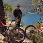
Mountain Bike Riding in NSW
There are numerous places in NSW that offer excellent mountain biking trails to suit all level of riders.
Below are some MTB highlights across different NSW regions. :
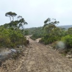
Mountain Bike Tracks in Western NSW
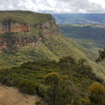
Narrow Neck Blue Mountains Distance: 20km return.
Difficulty: Medium. Location: Blue Mountains.
Rating: 5 Stars
|
Oaks Fire Trail, Blue Mountains Distance: 28km one way.
Difficulty: Medium. Location: Blue Mountains.
Rating: 5 Stars
|

Hanging Rock, Blue Mountains Distance: 12km return. |
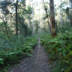
Blue Gum Swamp, Blue Mountains Distance: 10km loop.
Difficulty: Easy/Medium. Location: Blue Mountains.
Rating: 5 Stars
|
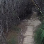
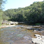
Mountain Bike Tracks South of Sydney.

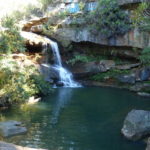
Eagle Rock, Royal National Park |
Royal National Park |

Woronora Pipeline/Dam Ride |
Little Marley, Royal National Park |
Mountain Bike Trails in the Illawarra and Shoalhaven.

Coondoo Single Track Distance: 10km loop
Difficulty: medium with technical sections. Where: South Nowra. Rating: 5 stars |

Superbowl Loop Distance: 6km loop |

Butterfly Loop Distance: 5.5km. |

Budderoo Mountain Bike Trail. Distance: 24km return. |
Cabbage Tree MTB Trail. Distance: 10km loop. |
McPhails MTB Trail. Distance: 26km return. |
Meryla Pass MTB Trail. Distance: 24km one way. |
Mountain Bike Riding North of Sydney.
Duckholes Trail Distance: 11km loop. |
Manly Dam Distance: 11km basic loop. |
Cascades Distance: 25+km trails. |
Terry Hills Perimeter Trail: Distance: 25km in and out. |

Old Mans Valley, Hornby Trail: Distance: 6km circuit. |
The map below contains mountain bike trails across NSW
loading map - please wait...
TAGS
Mountain bike, MTB, bicycle, ride, trail, track, bush, Sydney, South,